We begin our adventure in the village of Olleros, in the Cordillera Blanca, as we embark on a three-day trek through the Huascarán National Park, named after the 6.768 meter (22205 ft) high mountain of the same name.
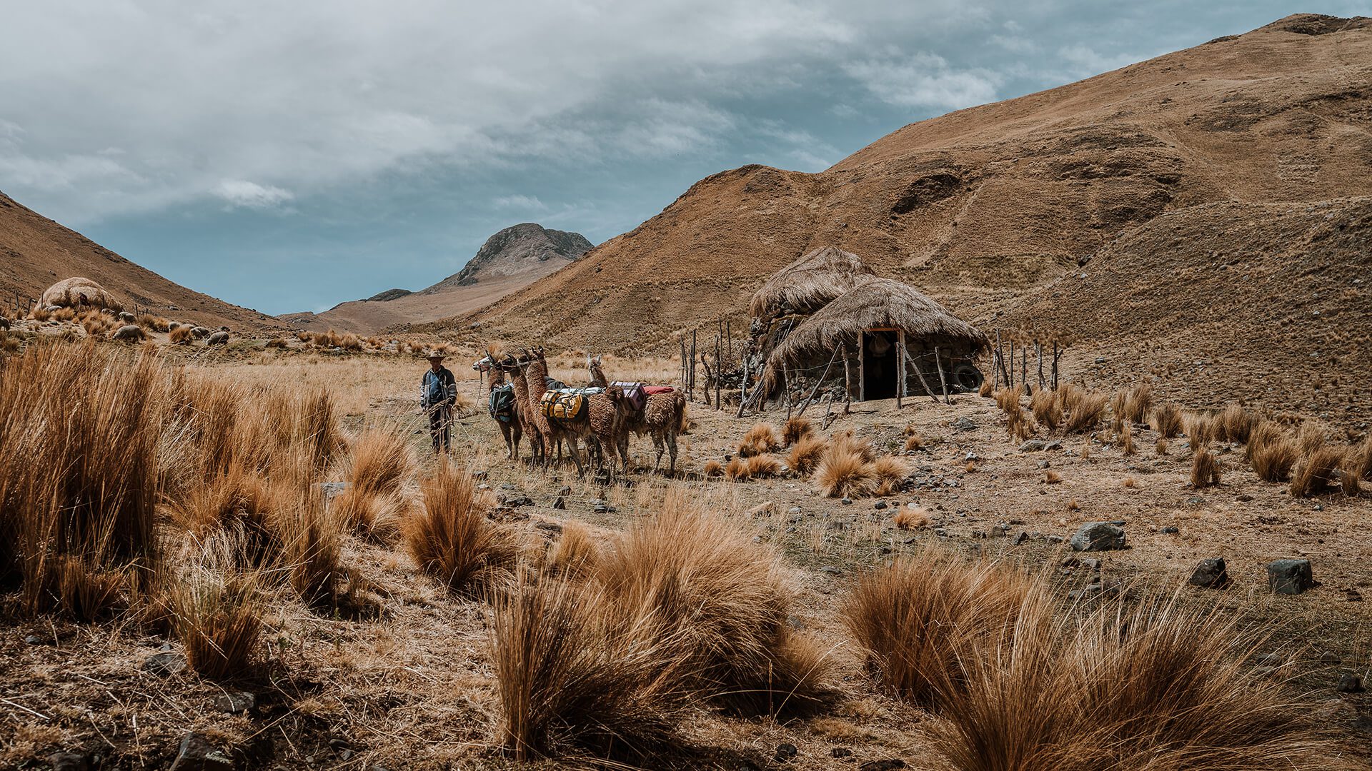
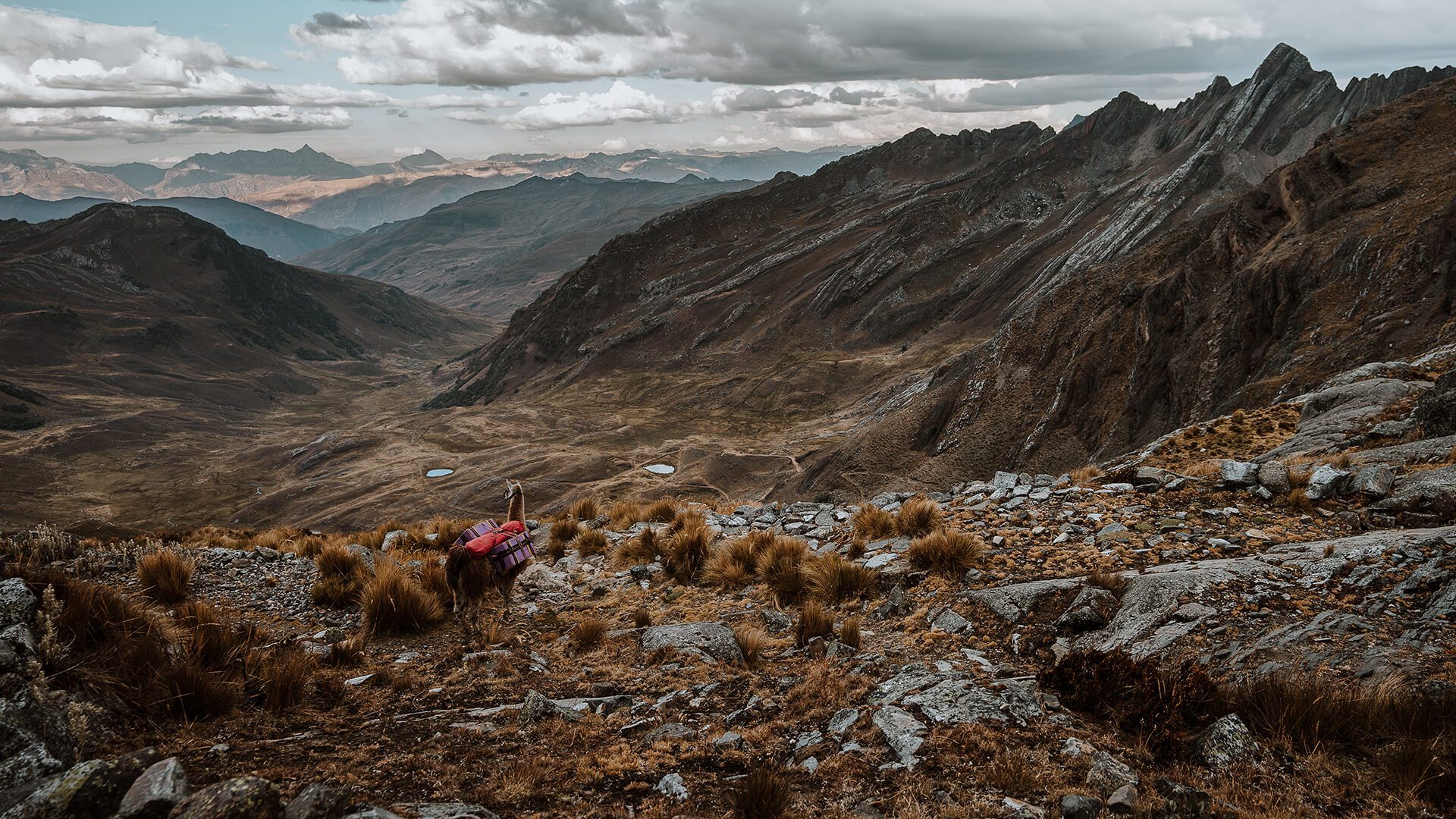
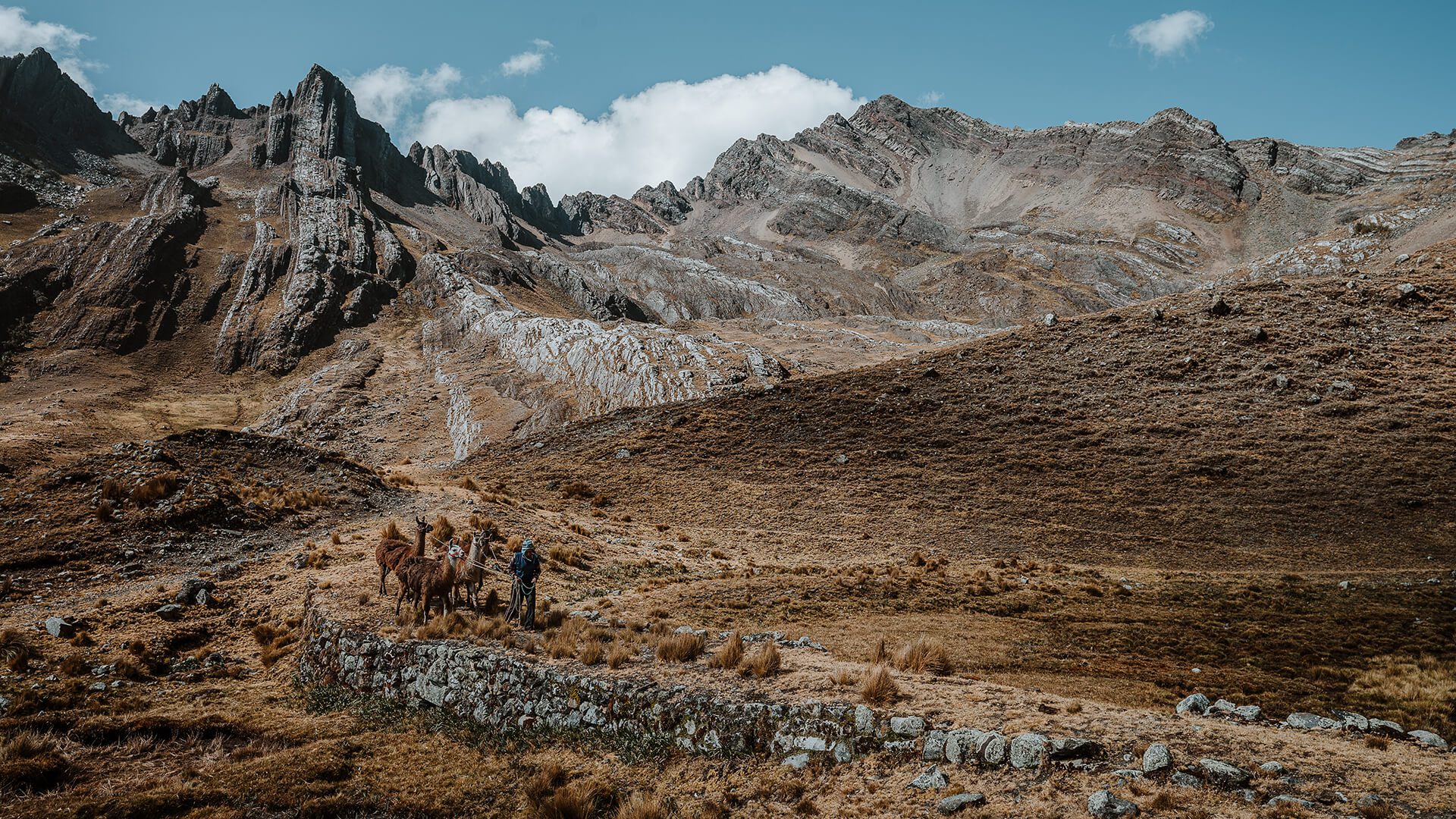
The 37-kilometer (23 mi) long llama trek in Cordillera Blanca leads largely along a “beaten path”: a more than three thousand-year-old trade and pilgrimage route, which connected the coastal areas with the Andes mountains and the Amazon. This route allowed pre-Inca peoples to trade and exchange knowledge. Like them, we cover the distance with pack animals (mostly llamas and aid horses) until we end up at the temple of Chavín de Huántar.
The idea for the llama trek originated in 1996, when mountain guides Jorge and Juan attended a tourism course in Huaraz. Juan had heard how the Quechua in Cusco posed with llamas and used them to make money. However, instead of posing, the community could also offer walking tours with llamas as pack animals, suggested Jorge.
Traditionally, the llama played an important role in the cultures of the Andean peoples, who kept this animal for their meat, wool and as beast of burden. The Spaniards introduced cows, sheep, horses and donkeys, which replaced the llama on every single aspect, and in consequence diminishing its use.
And so Jorge and Juan decided to use the llamas again as pack animals, for trekking in the mountains that they are familiar with. The Llama Trek was born.
If you are not an experienced trekker but still want to get to know a community in the Cordillera Blanca, you can! Have a look at the Complete Vicos Experience with Pachamanca (3 days) or the Most Authentic Community Experience in the Cordillera Blanca (2 days).
If on the contrary, you are a hiking fanatic and want to explore more of the Cordillera Blanca, you should not miss the Vicos to Ishinca trek (5 days of trekking in a 9-day program).
Finally, we highly recommend you Hike the prettiest stretch of Qhapaq Ñan in Huaraz, a beautiful adventure!
Check out our whole range of Peru Hiking Tours for more excursions along the country.
Price Includes
We leave Huaraz at 8:00 AM, driving for about an hour towards Olleros (specifically Canrey Chico) above 3.400 m.a.s.l. (11155 ft), where we find the Llama Breeding Center. From here, we start the hike accompanied by Jorge and the llama driver. But first, you will taste a typical breakfast with a family in the village.
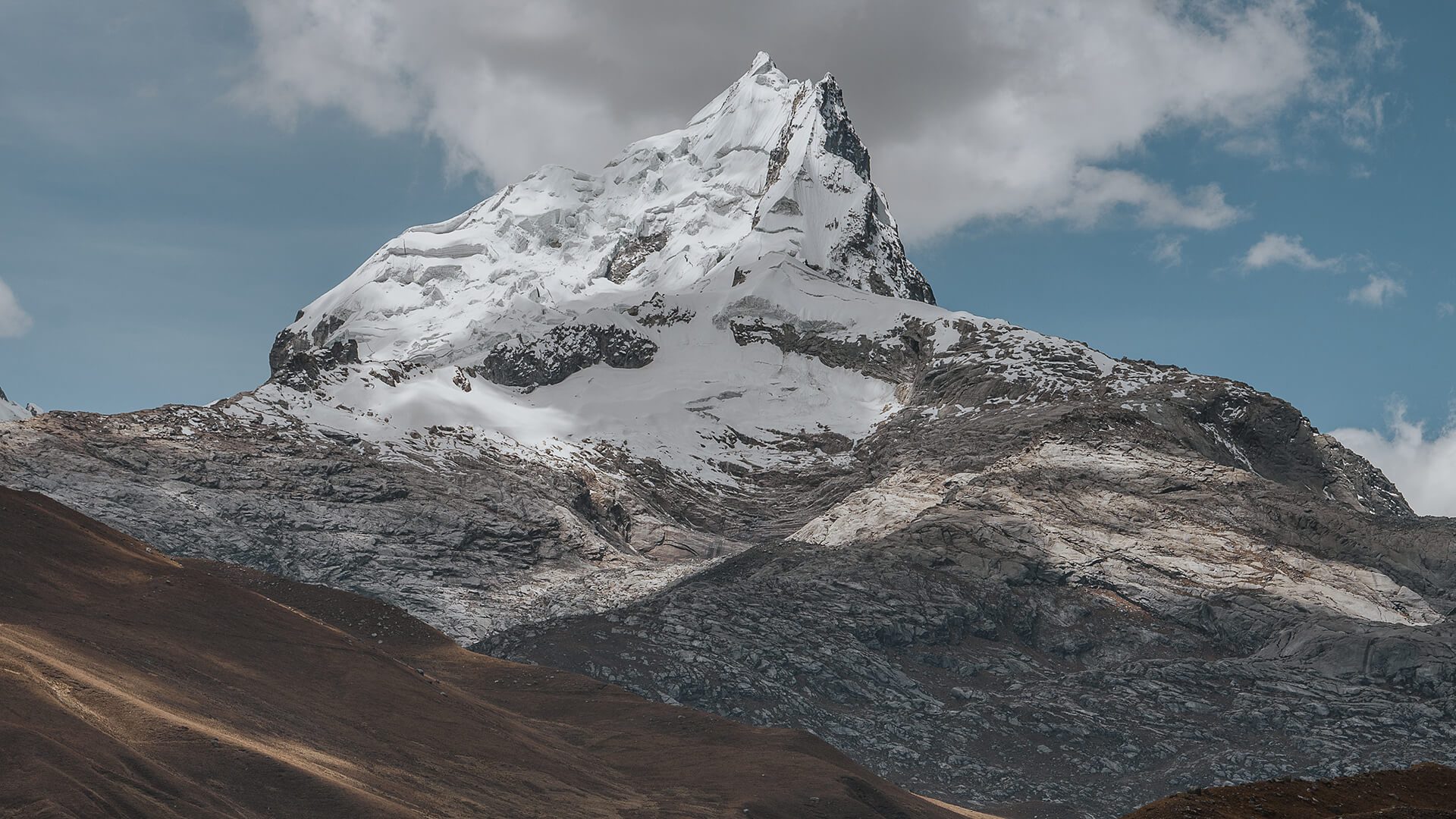
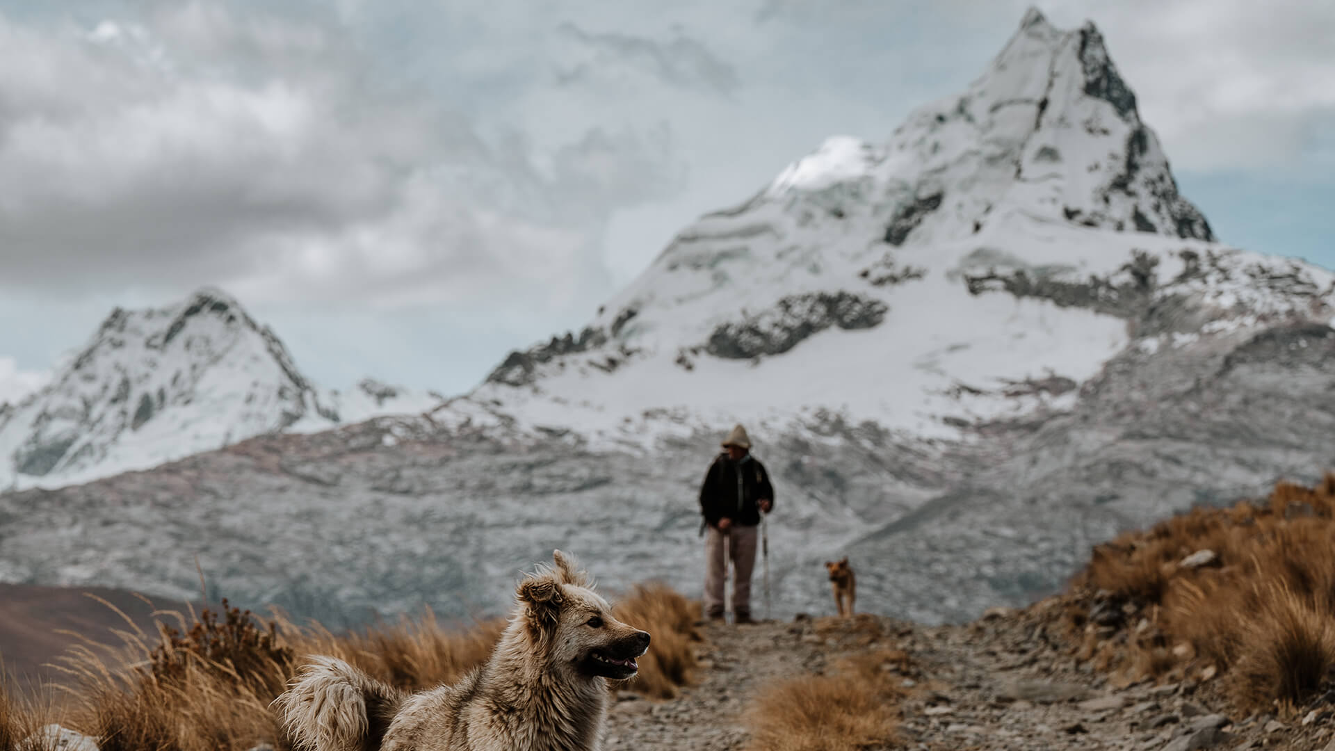
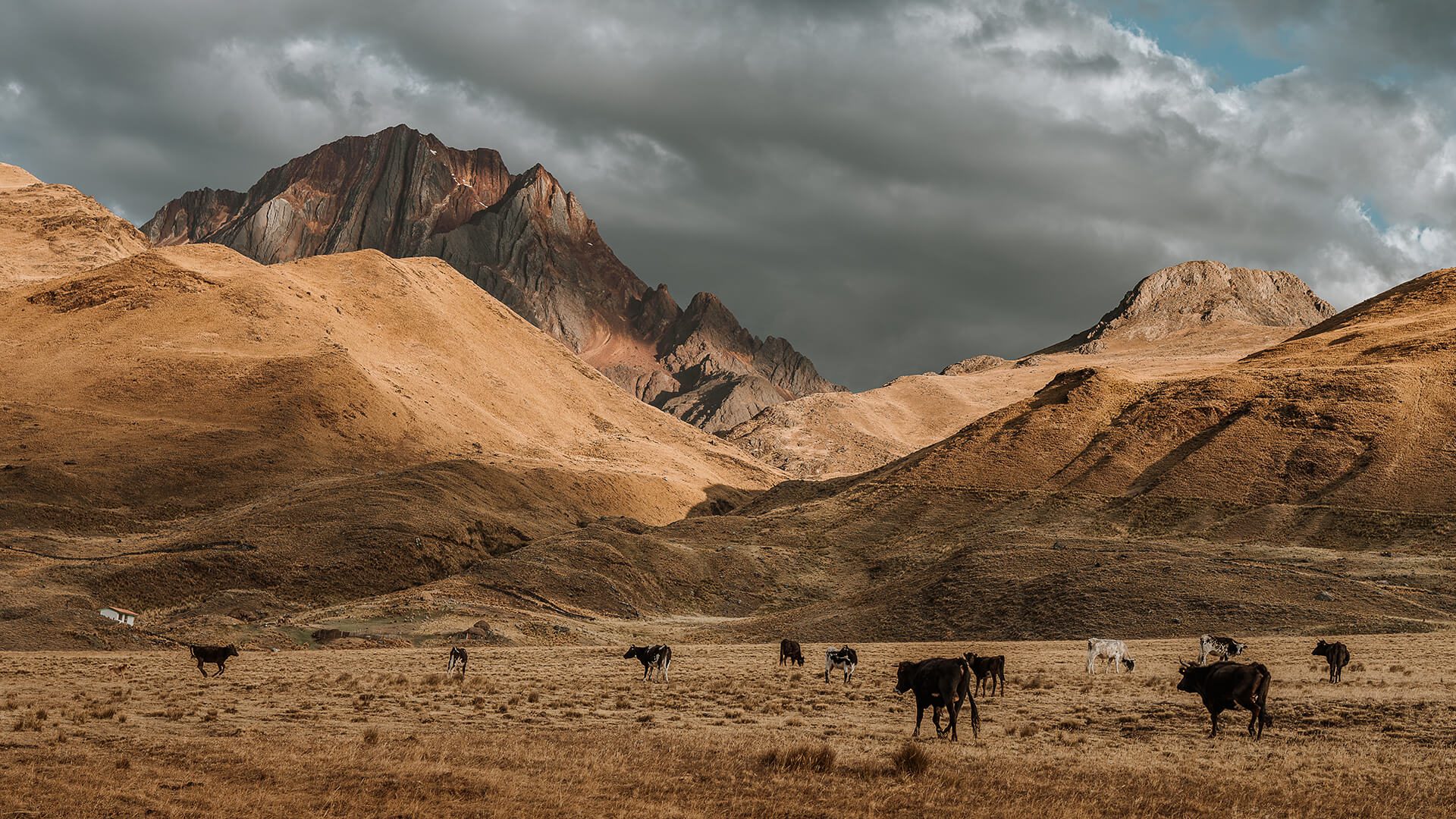
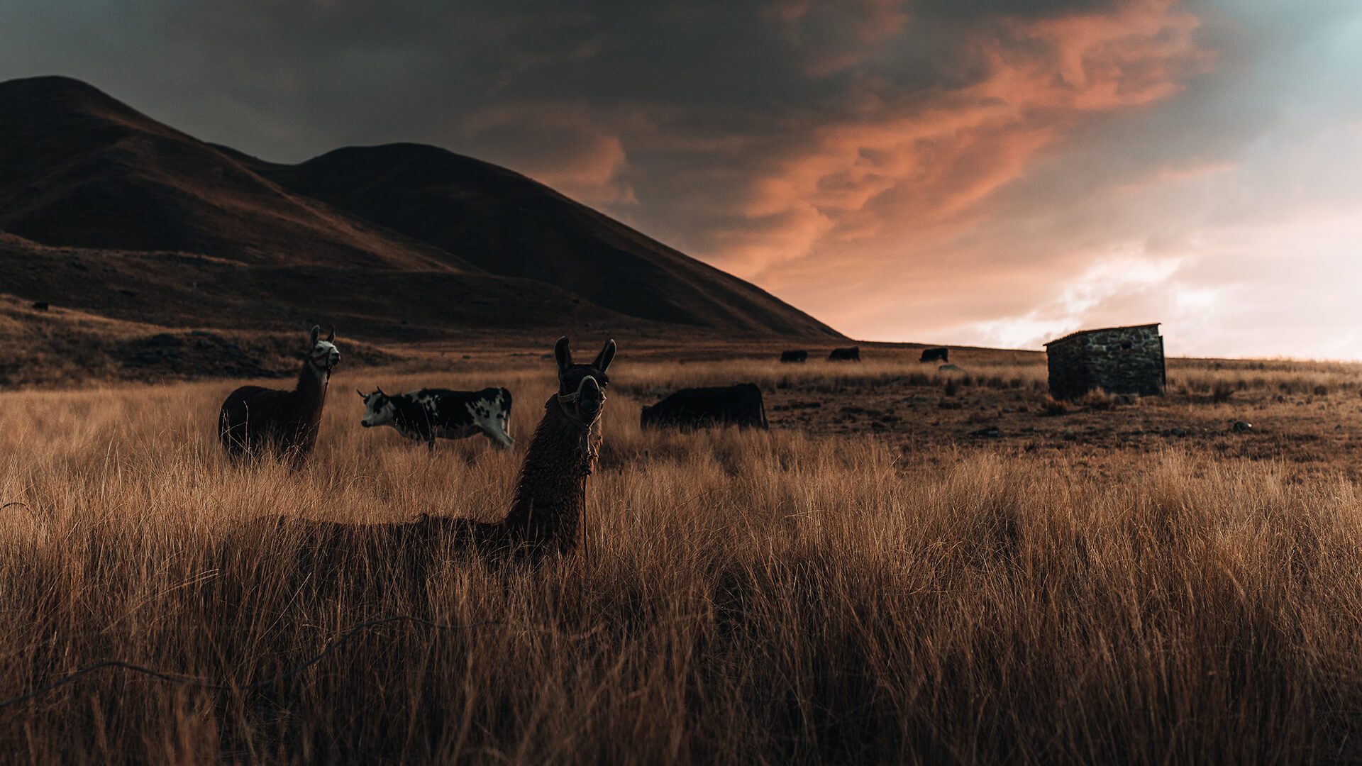
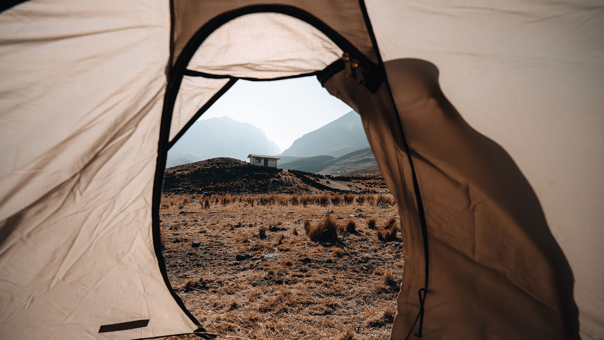
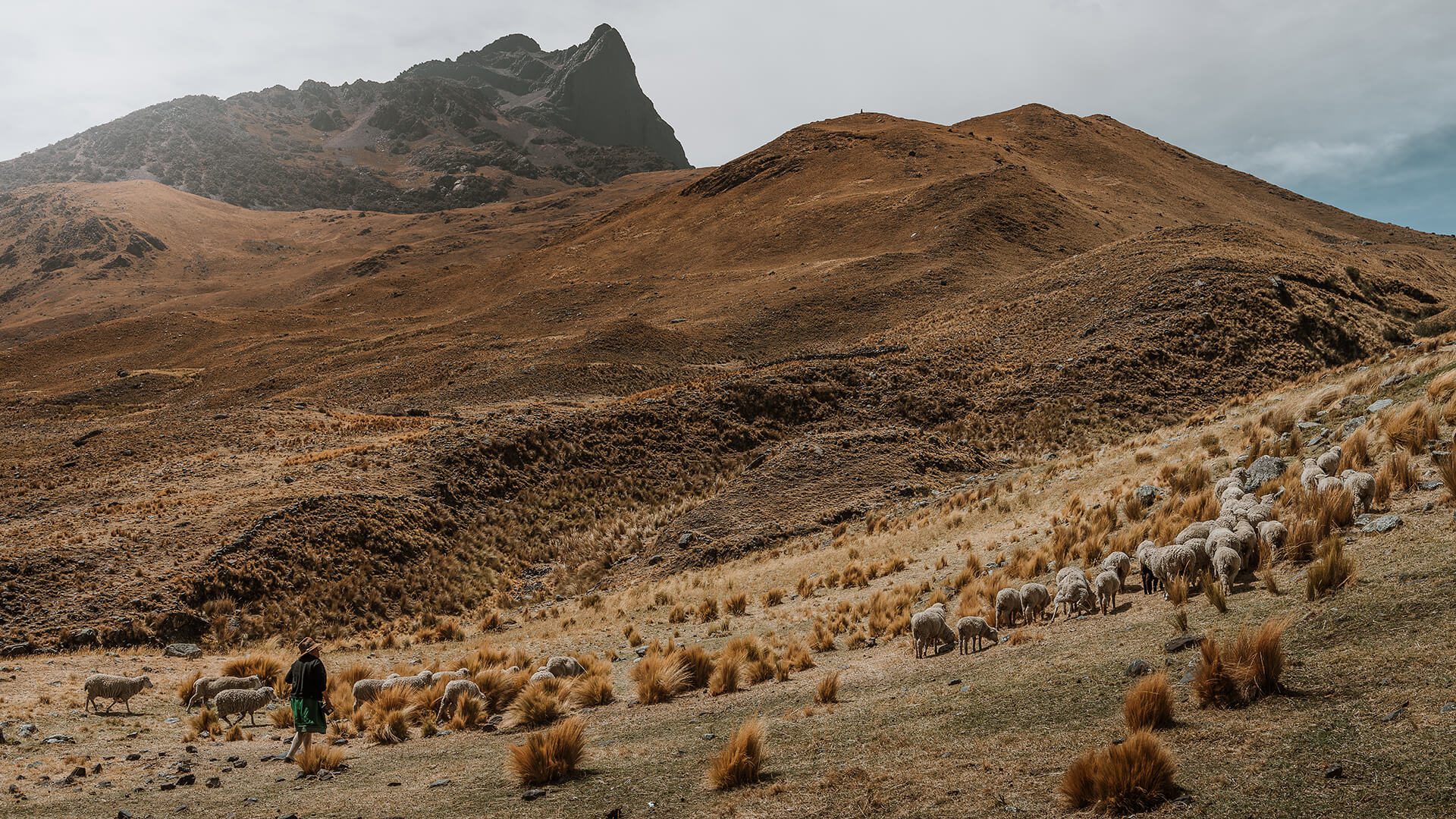
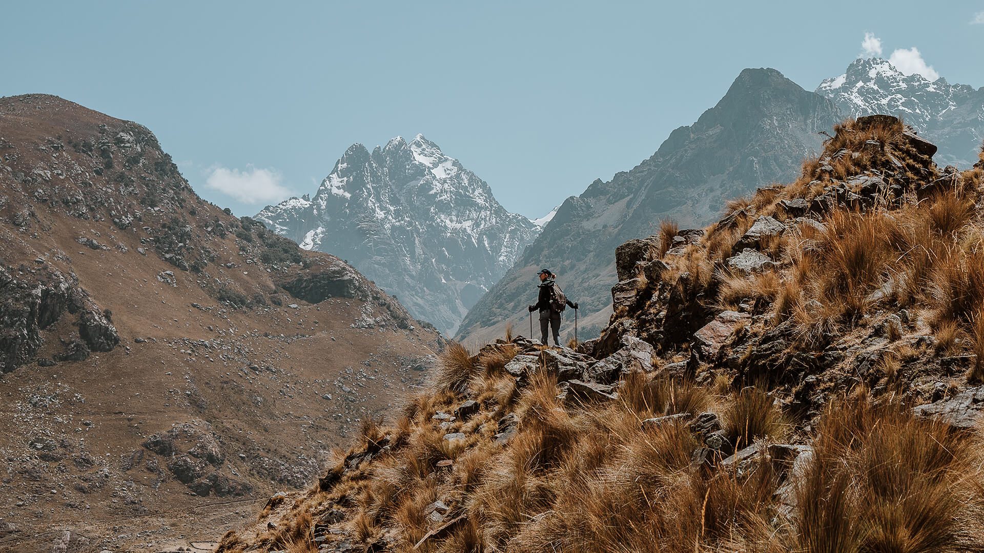
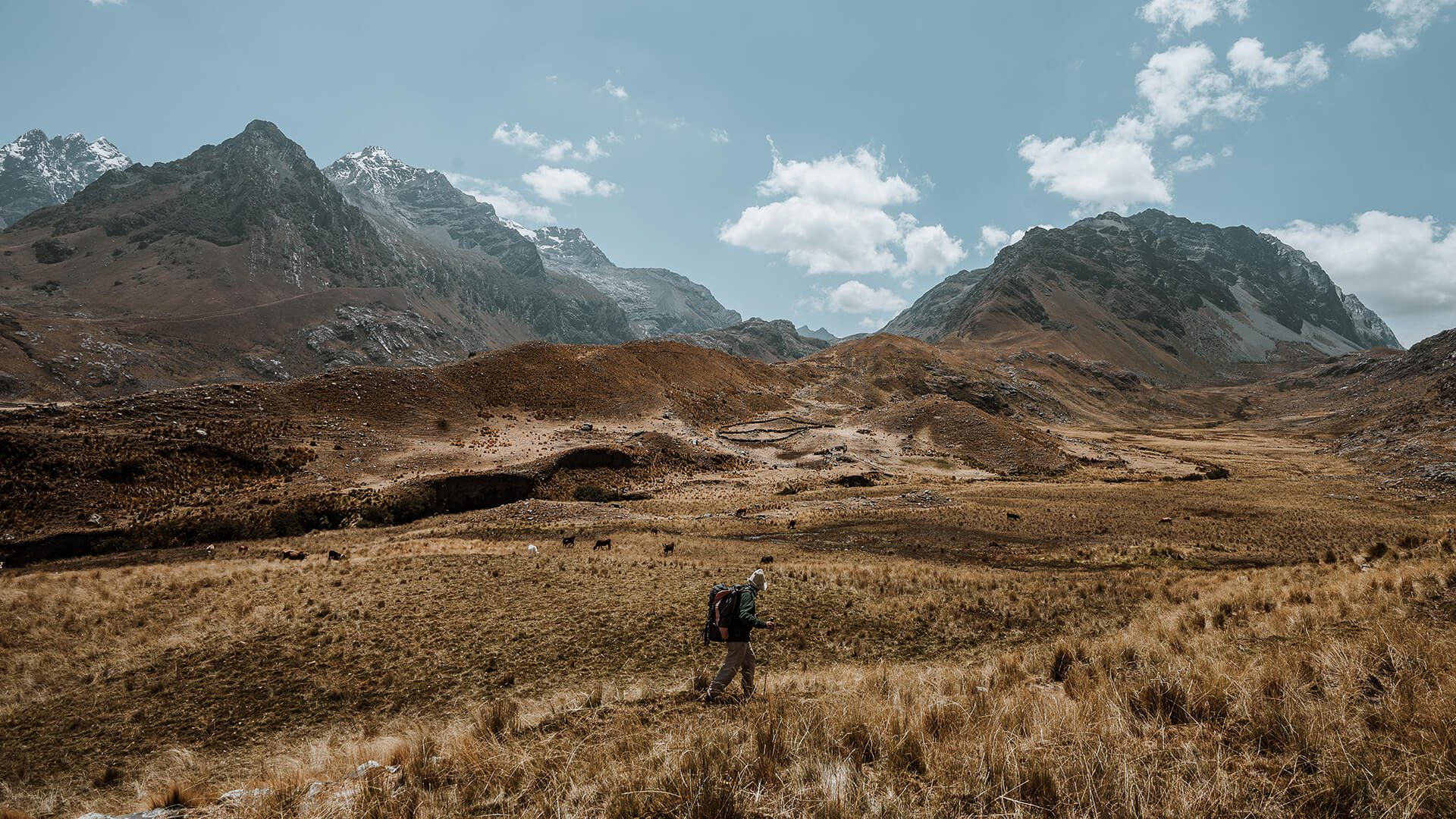
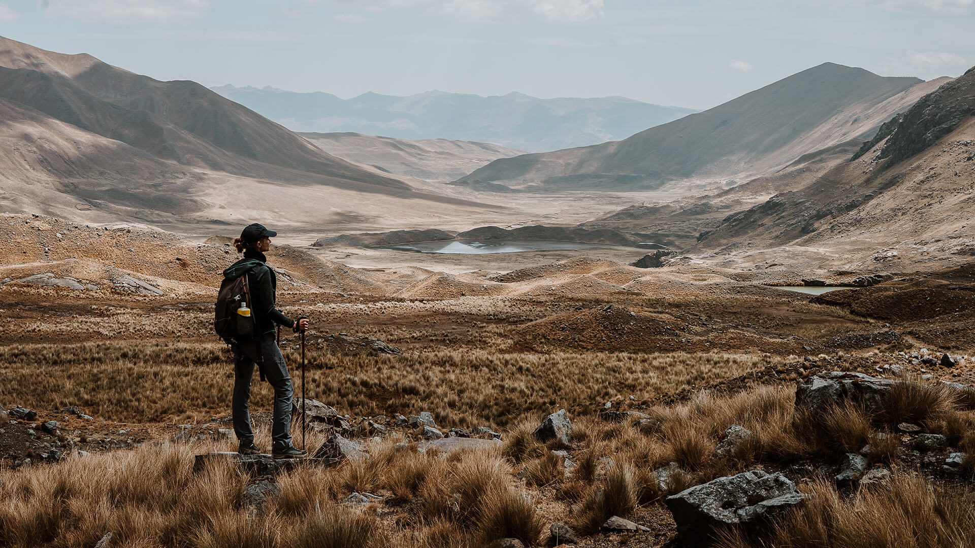
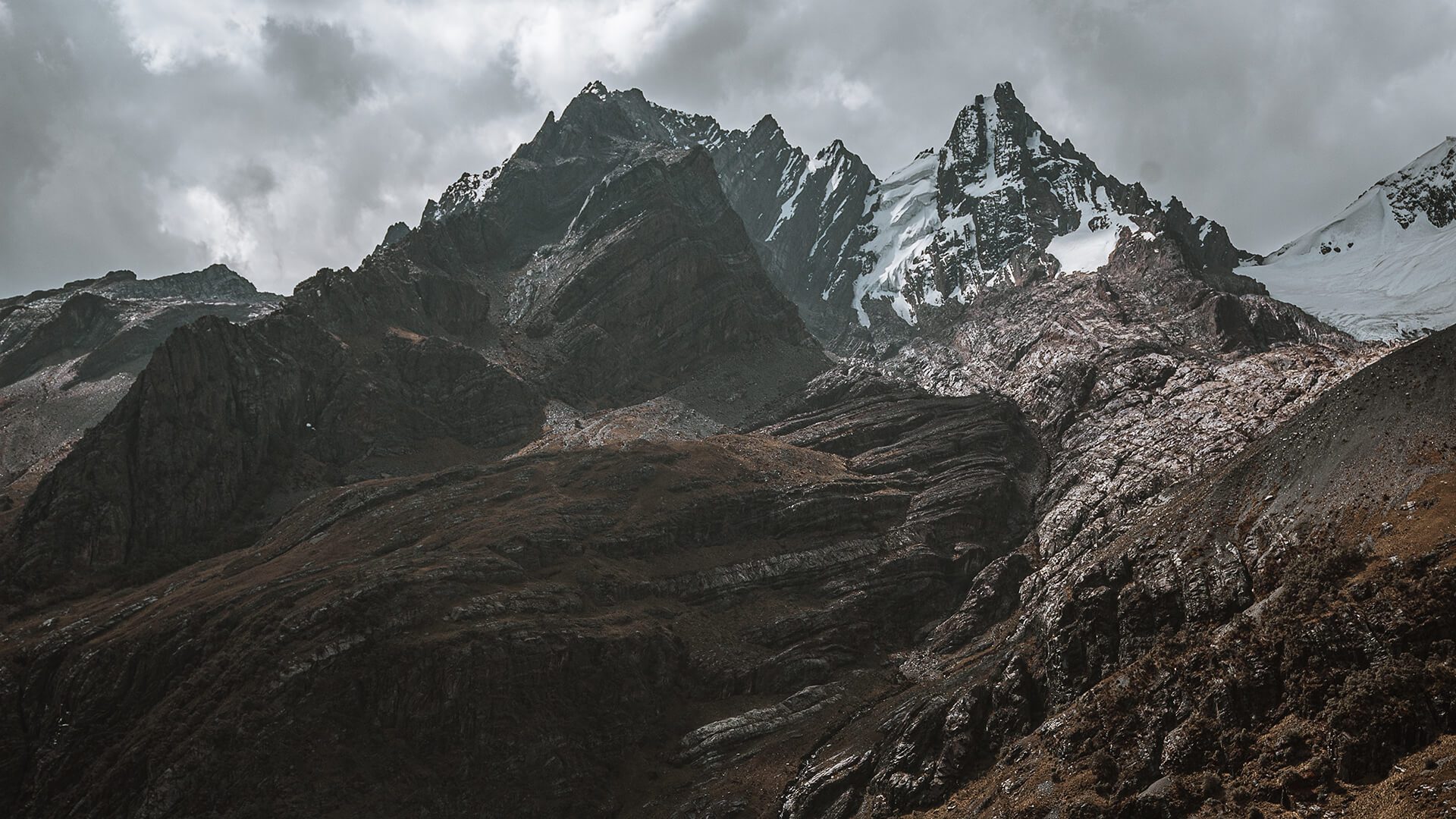
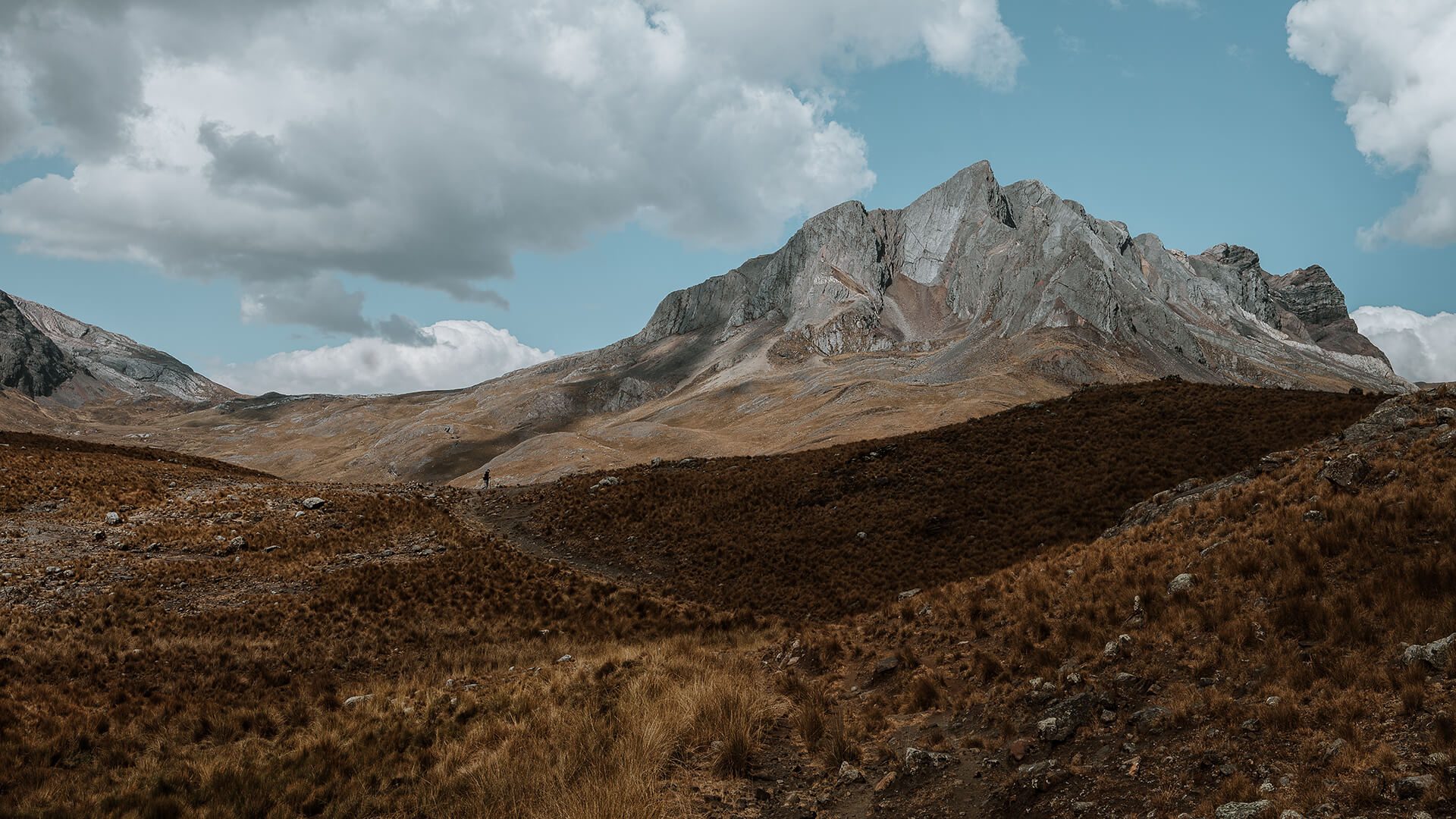
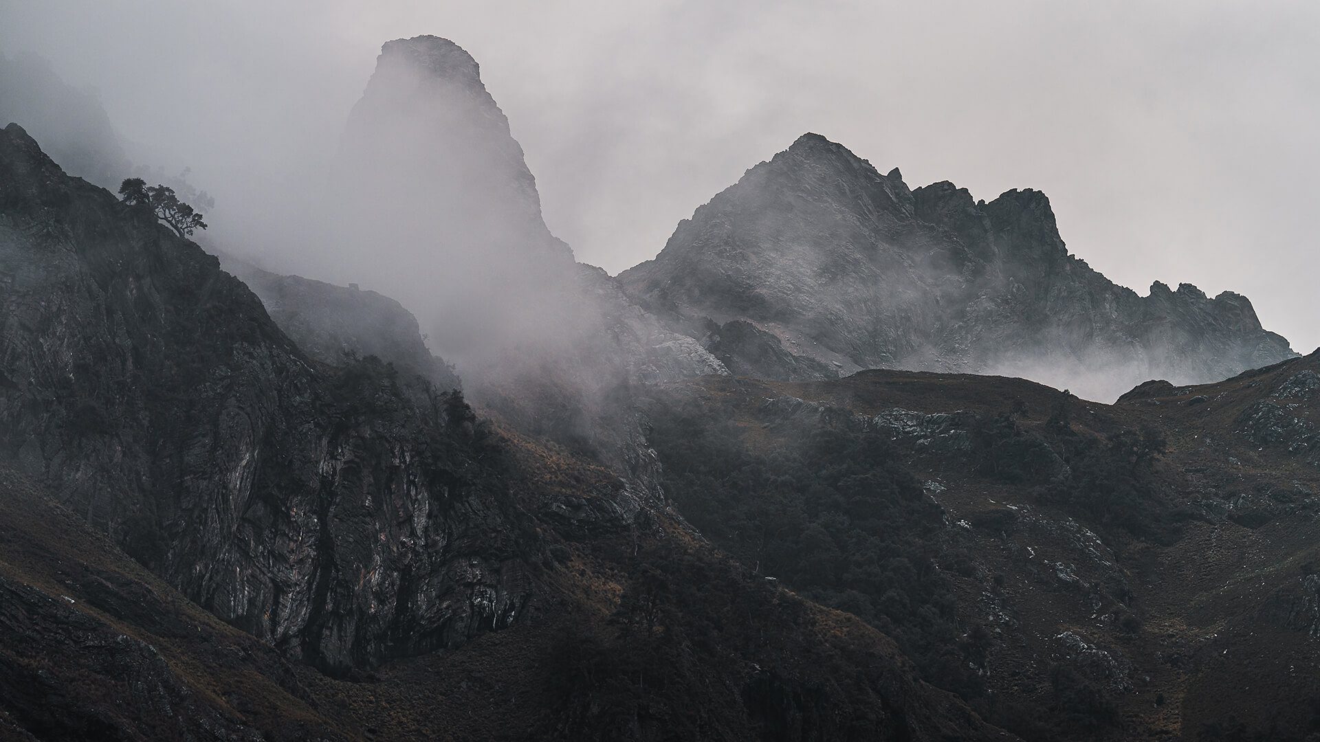
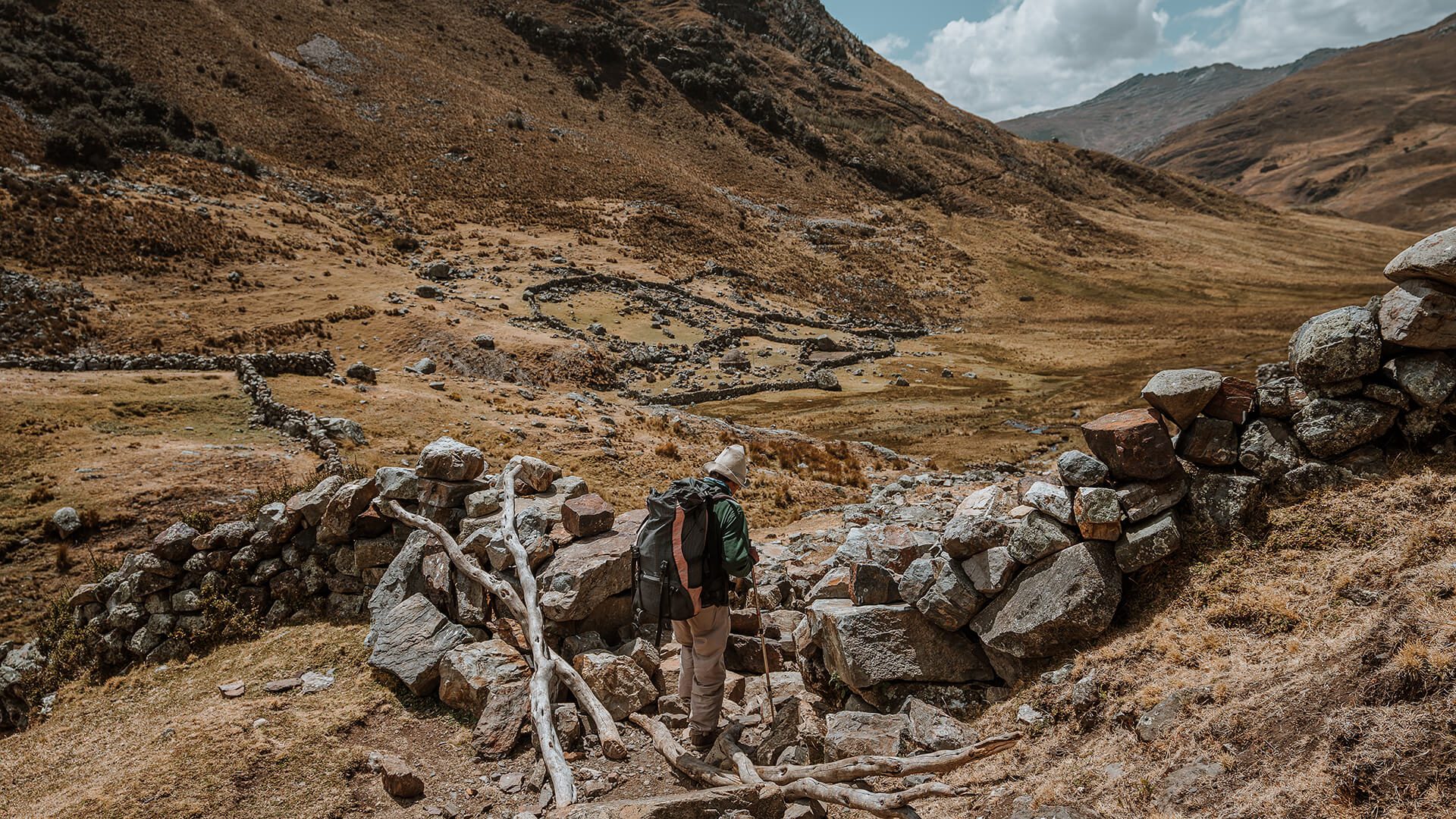
During the hike you will see very little signs of human life. The scenery is mostly a vast tundra, surrounded by snow-capped mountains. See the picture gallery to get a more precise idea of the landscape.
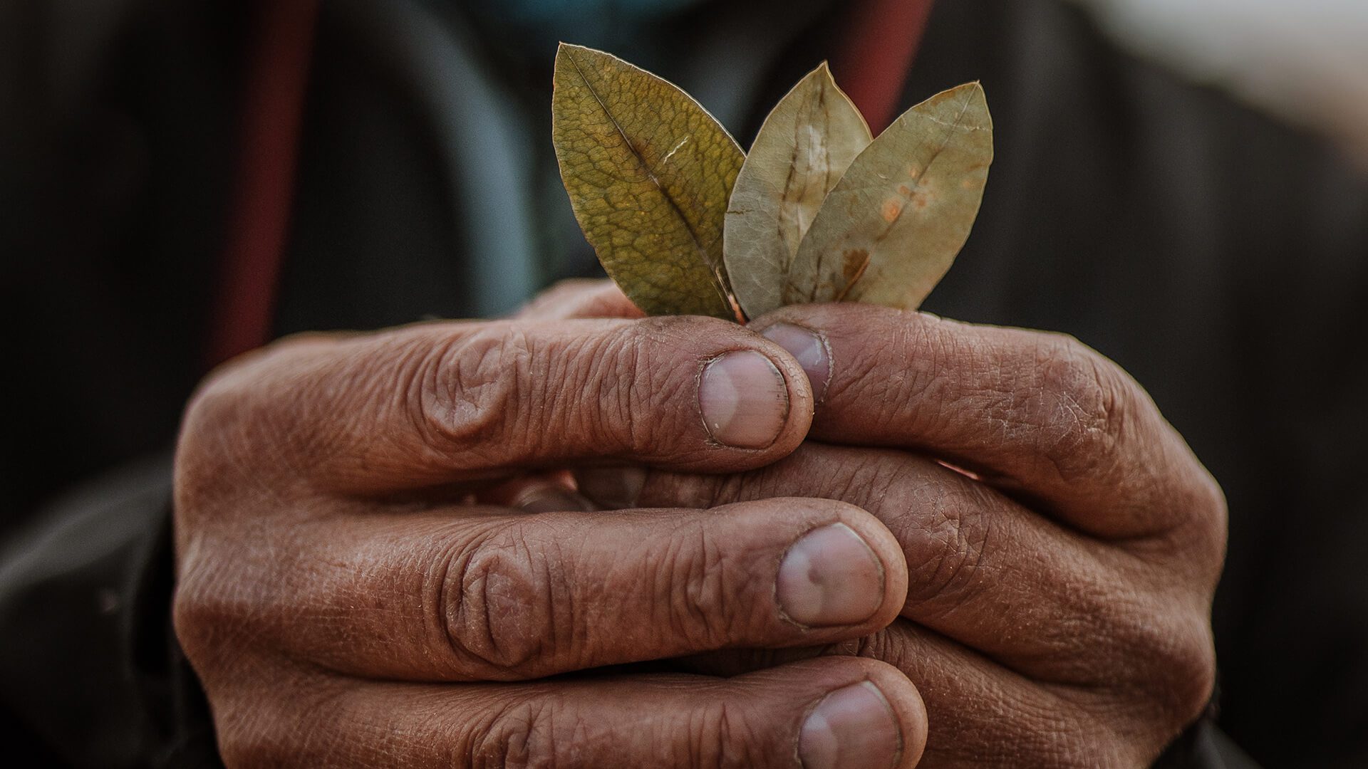
Close to ending today’s hike, we arrive at ‘Azulwanka‘ (a big man-sized rock obelisk), where we perform an Andean offering to the ‘Pachamama‘ (mother earth) presenting the ‘Kintu‘ (a traditional arrangement consisting of three coca leaves) in front of this important rock symbol, which represents the spirits of the mountains ‘Hirkas‘ and their sacredness.
The offering is carried out by the llama herder and the local guide, with your participation, to evoke your wishes through the “Sacred Leaf” and share them with the ‘Hirkas‘.
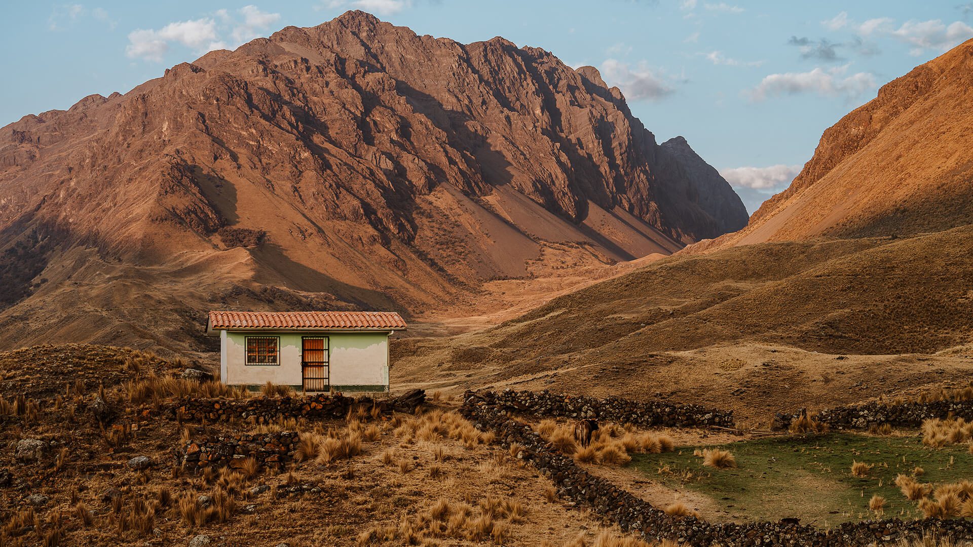
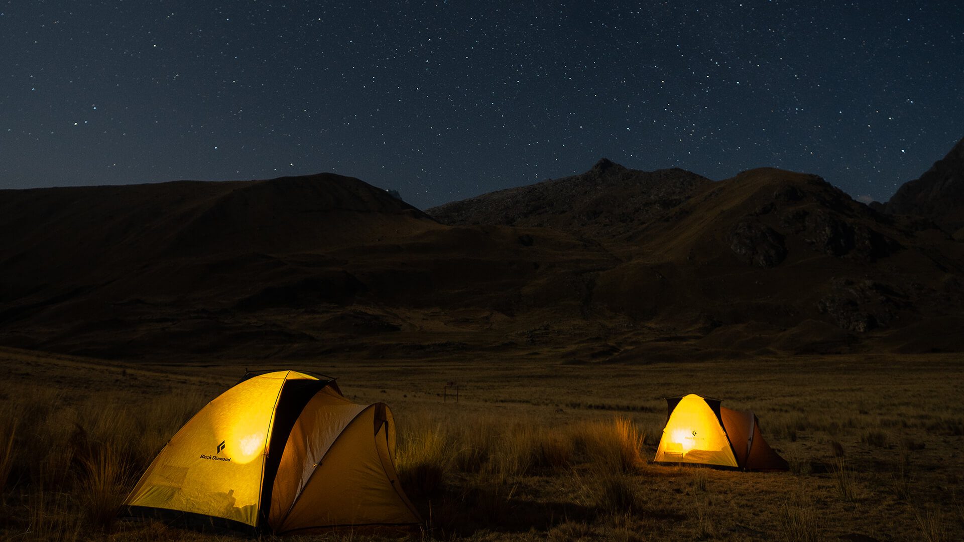
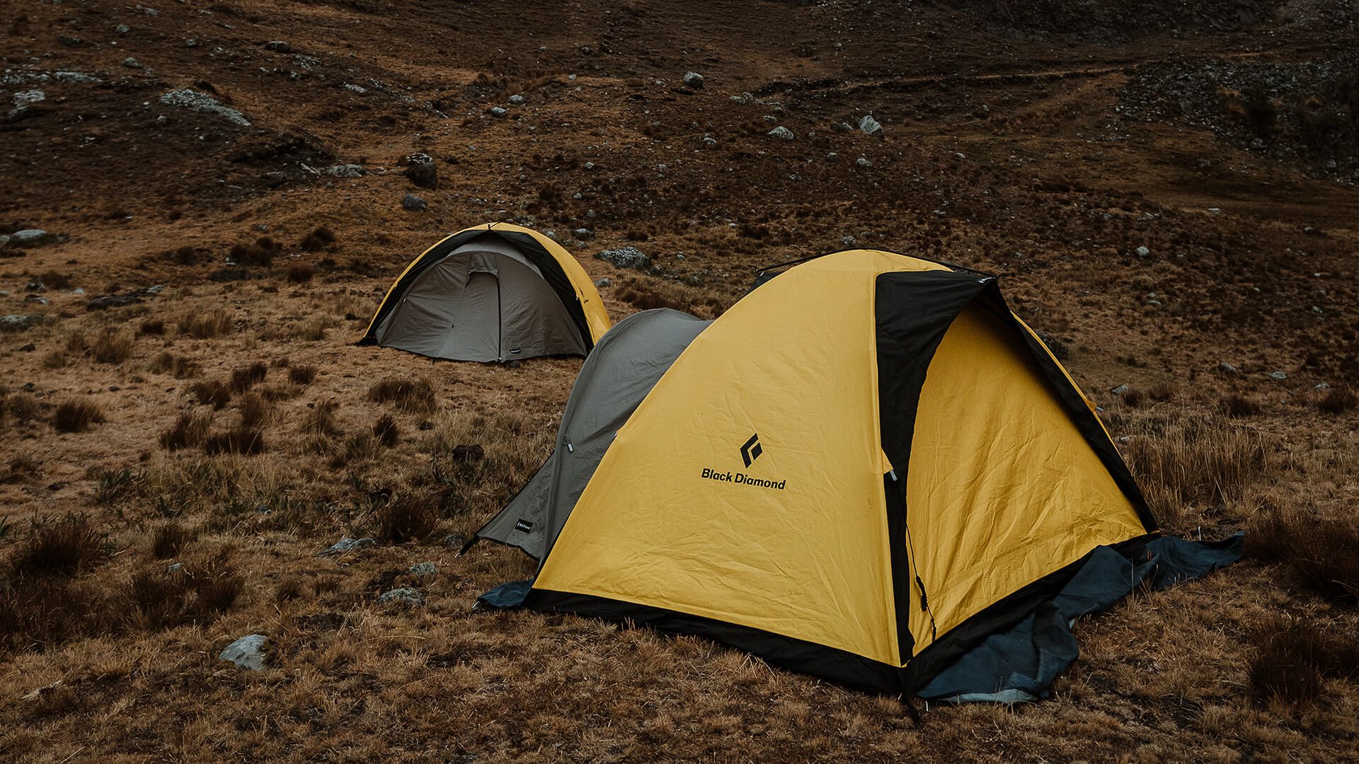
The next stop is already the camp, located in Tsacracancha (4.040 m / 13255 ft) where an Andean dinner will take place, tinged with local stories.
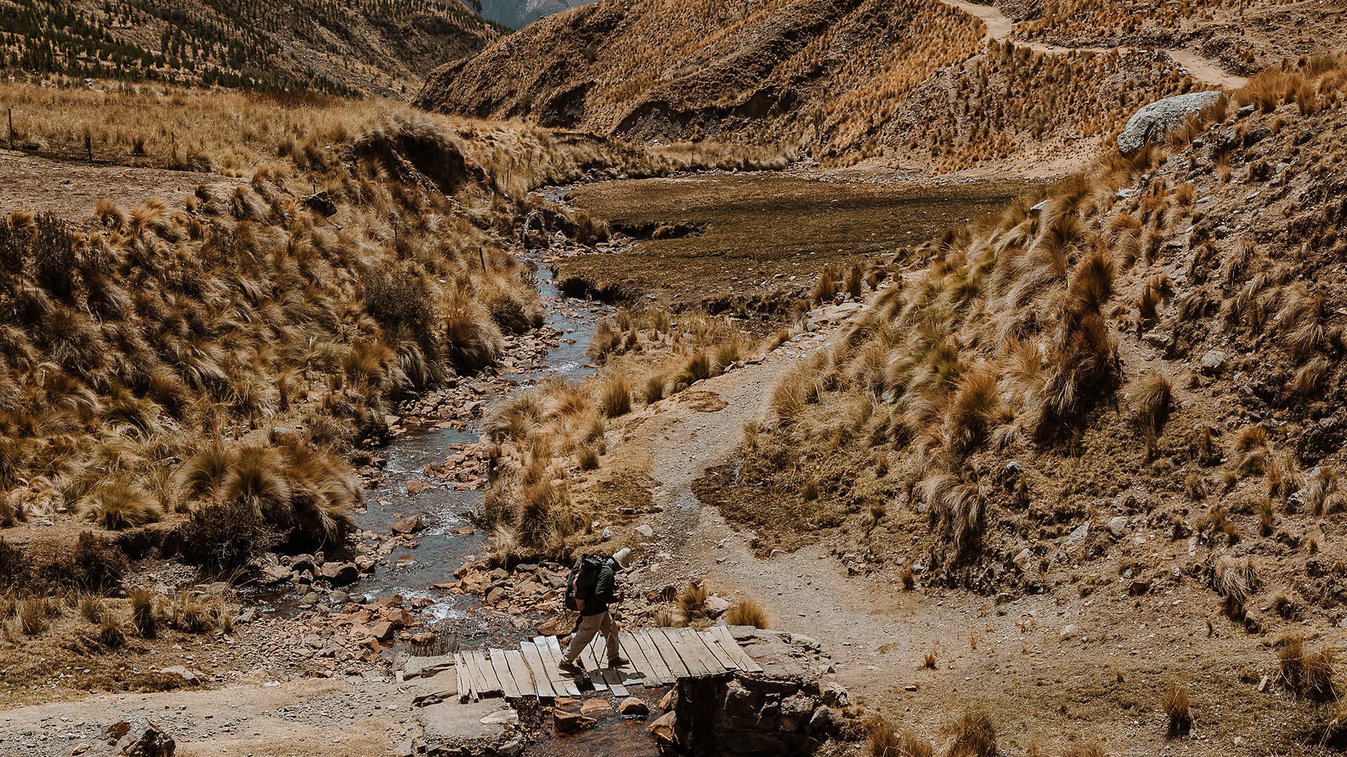
Today, the hike continues along the Pre-Inca trail. Further on, the stone path of the millenary road becomes more visible. These constructions initiated with the early Chavín culture around 1200 BC.
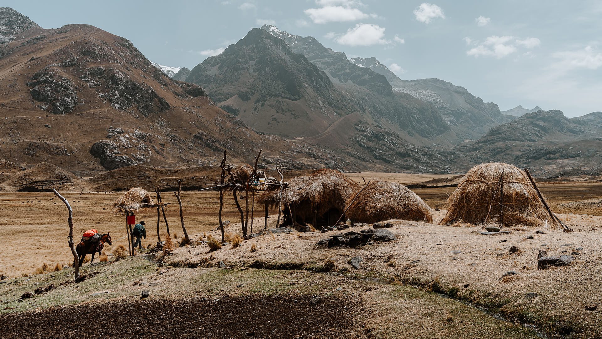
By midday we will climb up to the Yanashallash pass (4.681 m/15358 ft), the highest point of the circuit. At this altitude, we will participate in another traditional offering to the Mother Earth performed by the llama herders, maybe even under snowfall. Here you will see ‘chokus‘ (a display of carefully arranged rock piles aiming at expressing thankfulness to the spirits of the mountains for allowing passage).
From here, it is all downhill to Shongopampa (4.028 m/15420 ft), the lower valley where we will set up our second camp.
On our last day, we begin the descent back to civilization, to the village of Chichucancha and its stone-fenced fields. The people of this Andean community maintain ancestral, inka-style traditions in their homes.
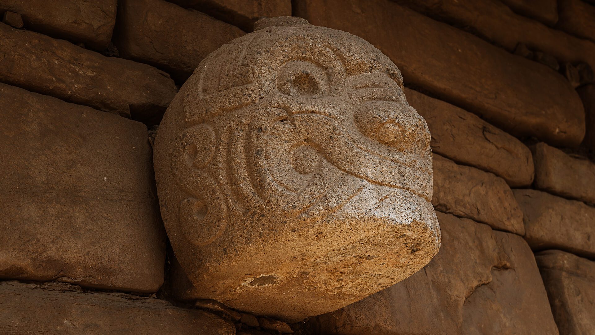
Here, private transportation will be taking us towards Chavín de Huántar. Once arrived, we will visit the archaeological site: a temple complex that materialized the power and prosperity of the Chavín culture. Here, the Chavín also met the almighty Pachamama representing all its levels:
Wander through the dark corridor system, make an imaginary sacrifice and learn about Andean cosmology in this nearly three-thousand-year-old complex. A must-see for lovers of archaeology and ancient cultures.
After this last highlights, you will return to Huaraz by car, which takes about 2.5 hours.

This route is entirely off-the-beaten-path, promoting at least a little interaction with local villagers in very remote settlements. It makes good use of a transversal section of the Great Inca Trail that used to connect most of the continent from north to south in pre-Columbian times.
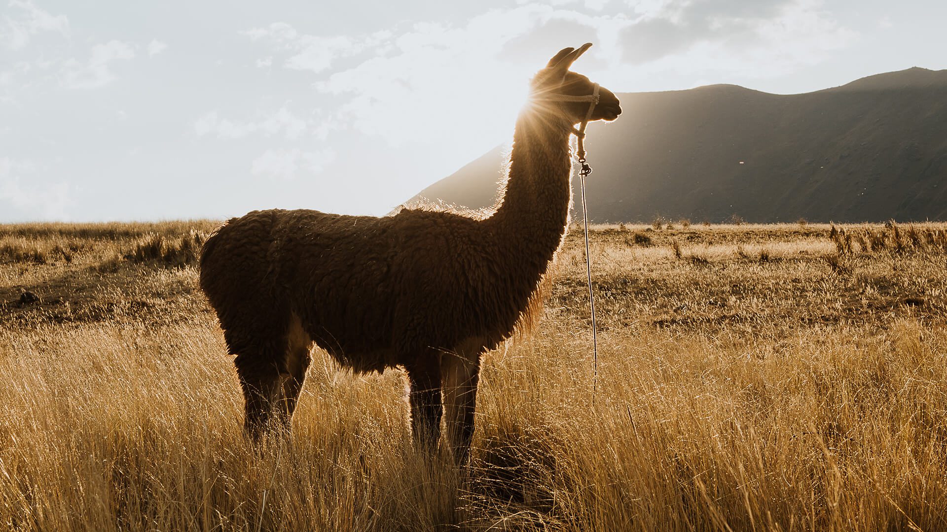
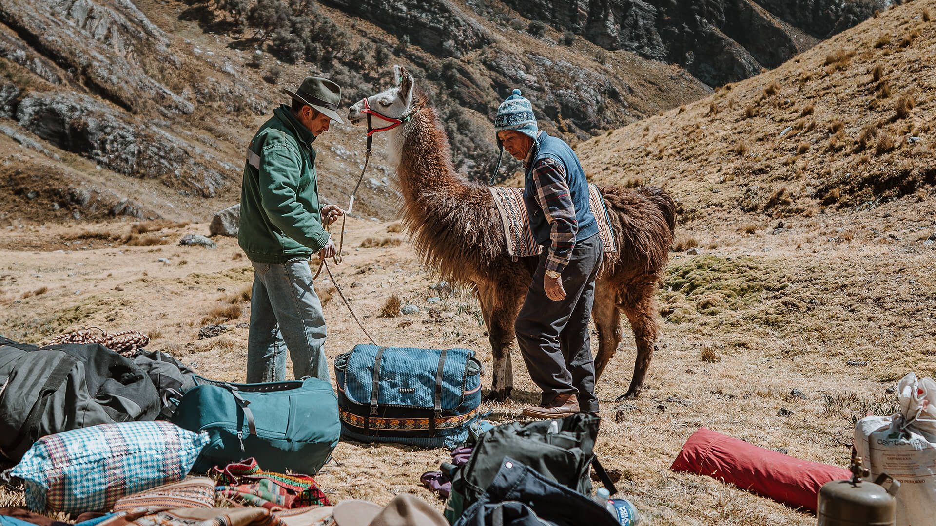
All the equipment and gear is carried by llamas that, as native beasts of burden, are adapted to this rough landscape. They also have soft pads under their feet; unlike horses and cows that wear out the ancient stone paths. Therefore, the llamas’ impact is minimal, both on nature and archaeological remains.
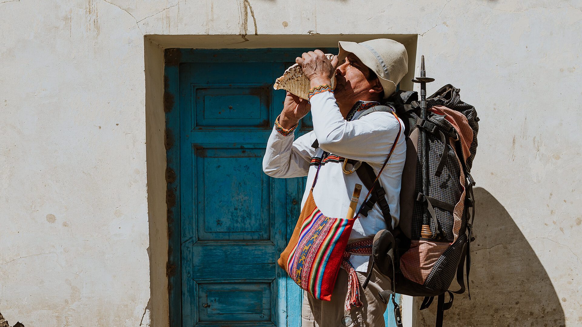
During the trek, ancestral traditions are performed with utmost respect and knowledge. This involves typical ceremonies of the people of the Andes and also the use of musical instruments along the hikes.
The whole initiative is 100% local, operated fully by the people from Canrey Chico who are organized in a community association. Jorge is one of the members.
Your participation in this trek contributes directly to the conservation and maintenance of the Huascarán National Park and the Chavín de Huántar Archaeological Site through the purchase of entrance tickets.

Since 1996, Jorge Martel has lead Canrey Chico’s efforts to develop sustainable tourism in their community. Ever since, he is the coordinator of the operations for Llama Trek 2000, the hike from Olleros to Chavín. Jorge is extremely passionate about his ancestral culture and loves sharing his stories in the dining tent at night. At the same time, he always ensures that the trek operations benefit the community as a whole and everything is operated in a respectful way not to harm nature, culture and the society. He isn’t always the guide, but sure will try to be for you! So come along and book this unique adventure with Jorge.
Llamas have been domesticated since many centuries. However, they are not pets. Especially in the first days, they will be wary of anyone coming close and might spit or even try to kick when they feel threatened by your presence. Your guide and the llama drivers will make sure to tell you when and how to approach the animals for a picture; but don’t expect a lot of hugging! Especially after the pandemic and political crisis, they need to readjust to having travelers around them again.
Children from the age of 6 can do this trek, despite its length and elevation, because they can make use of the aid horse if needed. However, take in consideration that nights can be pretty cold and that this is not a comfort tour, as any camping experience of this type.
The second day is quite a long hike up so some experience with long hikes is definitely required. After all, there’s only one aid horse and limited time. Every day you’re hiking between 4 and 6 hours.
Once you book this tour for you and your party, the date is automatically blocked, so no one else will be able to buy it for the same date.
Only if your desire is to share the costs with others, we can try to fit another group but only if the total of people doesn’t exceed the 6 persons.
In some occasions, we might ask you if you’re OK with sharing, if others really want to book on the same date.
The entrance fee to the Huascarán National Park and to the archaeological site are already included in the booking price, which is approx. $45 per person.
On day 2, you will get across the Yanashallash pass at about 4.700 meters (15420 ft).
Prepare for the typical Andean climate; when it’s sunny, it’s warm, when it’s cloudy, it’s cold. The rainy season is from December to April but occasional rains can occur anytime throughout the year. It can also get windy up there. From May to August night temperatures might go below freezing point.
Find more info about climates in Peru in our blog “Best Time to Travel to Peru“.
May through October is the best time to visit the Cordillera Blanca, because the rainy months go from January through March. Although, it also rains in November and December, but with less intensity and less frequency. The end of April is also an option because it is dry season already but still green.
For questions about booking a tour, prices, preparation for your trip, health and safety or other themes, please check our Frequently Asked Questions page. If you can’t find your question & answer, email us and we’ll add it!


